
Description
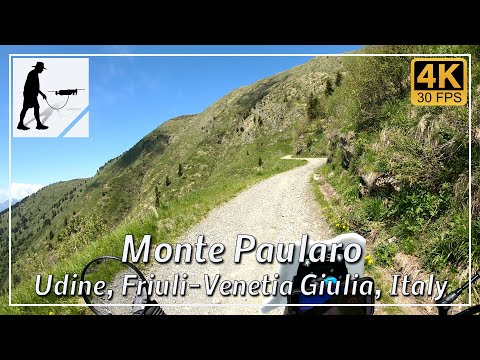
East of the village of Ligosullo, which lies about 4 km west of Paularo, an old military road branches off northwards from the SP 24 road. The junction is easy to find, as the restaurant ‘Osteria Al Camoscio’ is located directly above it. At first, the road is two-lane, well-maintained and easy to drive on. After about 4 km, shortly after Castello Valdajer, the road narrows and the asphalt surface changes to a well-maintained gravel road. You first drive up the southern slope of Monte Dimon, with only two wide hairpin bends ahead of you. South of Monte Dimon, you pass the small mountain lake Lago Dimon. The road turns west and after a total of just over 10 km, you reach the large turning area below Monte Paularo. In total, there is an elevation gain of about 900 metres from Ligosullo.
The road can be very busy with tourists up to Castello Valdajer. From there, you should watch out for hikers and cyclists on mountain bikes.
The road is located in the Italian province of Udine in the Friuli-Venezia Giulia region.
▬ Content ▬▬▬▬▬▬▬▬▬▬▬▬▬▬▬▬
00:00 Intro
00:15 Prolog
01:22 The Ride
20:57 And the Mavic spoke
24:57 Outro
▬ Links ▬▬▬▬▬▬▬▬▬▬▬▬▬▬▬▬▬
Playlist Italy: https://www.youtube.com/playlist?list=PLTYKWgwieoeK_DKMf6p7uRpSJtF_kd7G5
Playlist Passes: https://www.youtube.com/playlist?list=PLTYKWgwieoeK6AgzgiS20gB7sWXHpboC_
WalkTheMavic: https://www.youtube.com/channel/UCVKby-_mUxgoSbw19i30v6Q
▬ About this channel ▬▬▬▬▬▬▬▬▬▬▬▬
Walk The Mavic (WTM) – Interesting roads, passes and gorges in the Alps – Nature and landscapes – Castles, forts, fortresses and fortifications – Photos and videos, if possible and allowed, also aerial photos/videos with the drone.