
The ascent to Monte Zoufplan begins in the Italian village of Cercivento, which is located about 2 km west of the town of Paluzza and just under 2 km north of Sutrio.
The road starts at the cemetery in Cercivento at an altitude of about 600 metres above sea level and initially leads up the mountain through forest and meadowland. The former military road is narrow but paved and in good condition. After about 10 km, the paved section of the route ends at Pian delle Streghe and continues as a good gravel road to the transmission station on Monte Tenchia. Directly below the transmission station, which you reach after another 2 km, the path to Monte Zoufplan branches off sharply to the left/west. Straight ahead, the road would lead to Malgha Zoufplan bassa (lower Zouflan alpine pasture) after a short distance.
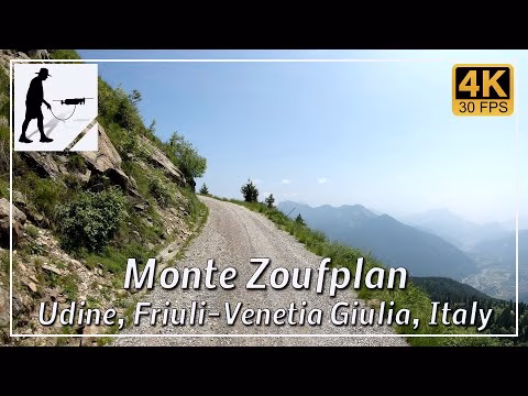
From this junction, the road becomes increasingly stony, rocky and, in some places, steeper. After another 3 km, you reach the turning point below the transmission station and the observatory on Monte Zoufplan, which is 2008 metres high.
It is forbidden to continue driving up the mountain and also on to the Panoramica delle Vette to the west. The entire route is more than 15 km long.
The road is located in the Italian province of Udine in the Friuli-Venezia Giulia region.
▬ Content ▬▬▬▬▬▬▬▬▬▬▬▬▬▬▬▬
00:00 Intro
00:15 Prolog
01:22 The Ride
30:20 And the Mavic spoke
34:20 Outro
▬ Links ▬▬▬▬▬▬▬▬▬▬▬▬▬▬▬▬▬
Playlist Italy: https://www.youtube.com/playlist?list=PLTYKWgwieoeK_DKMf6p7uRpSJtF_kd7G5
Playlist Passes: https://www.youtube.com/playlist?list=PLTYKWgwieoeK6AgzgiS20gB7sWXHpboC_
WalkTheMavic: https://www.youtube.com/channel/UCVKby-_mUxgoSbw19i30v6Q
▬ About this channel ▬▬▬▬▬▬▬▬▬▬▬▬
Walk The Mavic (WTM) – Interesting roads, passes and gorges in the Alps – Nature and landscapes – Castles, forts, fortresses and fortifications – Photos and videos, if possible and allowed, also aerial photos/videos with the drone.