
Description
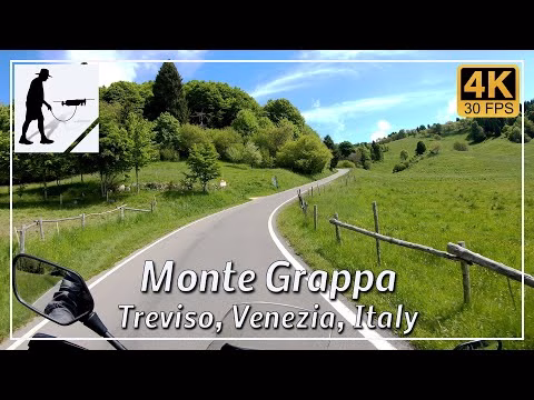
Of the four main ascents to Monte Grappa (1,775 metres), this section describes the route via the SP140 road, which starts in the village of Semonzo, right next to the church. From Semonzo, it is just over 19 kilometres and almost 1,600 metres of elevation gain.
Monte Grappa is the highest mountain in the Grappa massif, which forms the southern end of the Dolomites before continuing south into the Venetian plain. The southern slope of the massif is very popular with paragliders.
During the so-called Piave Battles in the First World War, well over 22,000 soldiers died on the Grappa massif, whose remains are buried in an ossuary and war memorial built around 1930.
The road is well constructed and easy to drive on overall. At the beginning, however, there are a large number of narrow hairpin bends. In the last third, the road becomes noticeably narrower and more confusing, so you should pay particular attention to oncoming traffic here.
The road is located in the Italian province of Treviso in the Veneto region.
▬ Content ▬▬▬▬▬▬▬▬▬▬▬▬▬▬▬▬
00:00 Intro
00:15 Prolog
01:22 The Ride
27:21 And the Mavic spoke
31:21 Outro
▬ Links ▬▬▬▬▬▬▬▬▬▬▬▬▬▬▬▬▬
Playlist Italy: https://www.youtube.com/playlist?list=PLTYKWgwieoeK_DKMf6p7uRpSJtF_kd7G5
Playlist Passes: https://www.youtube.com/playlist?list=PLTYKWgwieoeK6AgzgiS20gB7sWXHpboC_
WalkTheMavic: https://www.youtube.com/channel/UCVKby-_mUxgoSbw19i30v6Q
▬ About this channel ▬▬▬▬▬▬▬▬▬▬▬▬
Walk The Mavic (WTM) – Interesting roads, passes and gorges in the Alps – Nature and landscapes – Castles, forts, fortresses and fortifications – Photos and videos, if possible and allowed, also aerial photos/videos with the drone.