
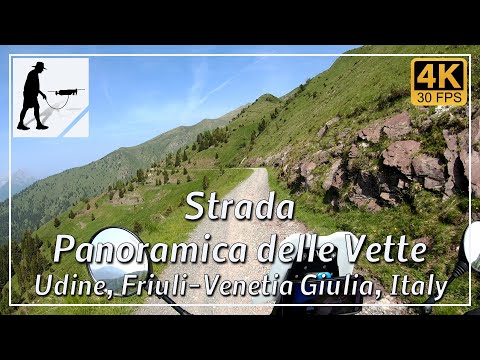
Description
The Panoramica delle Vette is a trail originally built to supply the mountain pastures situated on the southern flank of the mountain range surrounding Monte Crostis. The trail, which is approximately 28 km long, begins and ends in the villages of Tualis to the west and Ravascletto to the east. Tualis lies north of Comeglians, whilst Ravascletto is situated between Comeglians and Sutrio.
From Tualis or Ravascletto, you must first negotiate the ascents, which consist of numerous, sometimes steep hairpin bends, as the actual panoramic road reaches an altitude of almost 2,000 metres. Of the 28 km route, only about 5 km are unpaved. However, this gravel section is in good condition and consists of fine gravel. It can only become a little slippery when wet.
For a very rewarding drive along this route, the village of Ravascletto is recommended as the starting point. This way, you mostly drive the route ‘anti-clockwise’ and are somewhat less exposed to the risk of being pushed down the slope by oncoming traffic. Overall, however, the route is easy to drive.
The road is located in the Italian province of Udine, in the Friuli-Venezia Giulia region.
▬ Content ▬▬▬▬▬▬▬▬▬▬▬▬▬▬▬▬
00:00 Intro
00:15 Prolog
01:22 The Ride
47:19 And the Mavic spoke
51:19 Outro
▬ Links ▬▬▬▬▬▬▬▬▬▬▬▬▬▬▬▬▬
Playlist Italy: https://www.youtube.com/playlist?list=PLTYKWgwieoeK_DKMf6p7uRpSJtF_kd7G5
Playlist Passes: https://www.youtube.com/playlist?list=PLTYKWgwieoeK6AgzgiS20gB7sWXHpboC_
WalkTheMavic: https://www.youtube.com/channel/UCVKby-_mUxgoSbw19i30v6Q
▬ About this channel ▬▬▬▬▬▬▬▬▬▬▬▬
Walk The Mavic (WTM) – Interesting roads, passes and gorges in the Alps – Nature and landscapes – Castles, forts, fortresses and fortifications – Photos and videos, if possible and allowed, also aerial photos/videos with the drone.