
Description
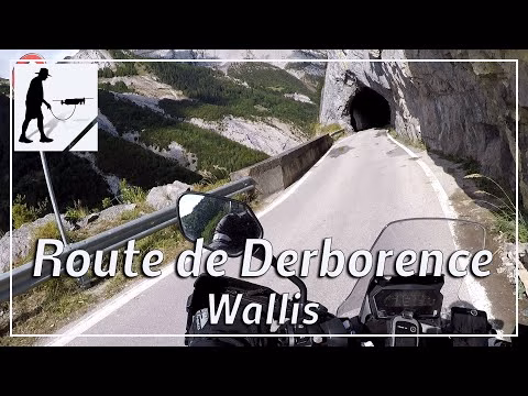
About 8 km west of the cantonal capital Sitten / Sion in the valley of the Rhône, the village of Aven is located at an altitude of about 1000 meters above sea level. Shortly above, at the chapel of St. Bernard, the road begins, which is about 10 km long and leads north through the valley of the river Lizerne to the Lac de Derborence (about 1500 meters). In 1749 the lake, which is now a nature reserve, was dammed by a huge rockfall of the mountain Les Diablerets. The valley lies in the district of Conthey in the canton of Valais in Switzerland. The road is largely cut into the vertical rock, passes through a large number of smaller tunnels and lies about 300 meters above the valley floor.
This route belongs to the so-called "Swiss Balcony Roads".
▬ Content ▬▬▬▬▬▬▬▬▬▬▬▬▬▬▬▬
00:00 Intro
00:15 Prolog
01:08 The Ride
13:45 Outro
▬ Links ▬▬▬▬▬▬▬▬▬▬▬▬▬▬▬▬▬
Playlist Switzerland: https://www.youtube.com/playlist?list=PLTYKWgwieoeLPJhJy01LzHE2x9zzfpATE
Playlist Gorges: https://www.youtube.com/playlist?list=PLTYKWgwieoeJHap1bKTsn_Pcjo8_V89rP
WalkTheMavic: https://www.youtube.com/channel/UCVKby-_mUxgoSbw19i30v6Q
▬ About this channel ▬▬▬▬▬▬▬▬▬▬▬▬
Walk The Mavic (WTM) – Interesting roads, passes and gorges in the Alps – Nature and landscapes – Castles, forts, fortresses and fortifications – Photos and videos, if possible and allowed, also aerial photos/videos with the drone.