
Description
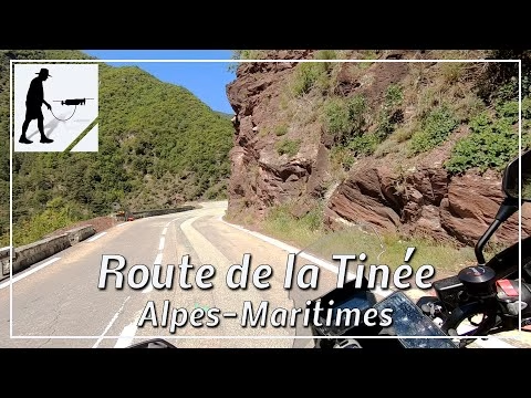
South of the village of La Courbaisse, the Tinée River flows into the Var River, which comes from the west. This is where the Val de la Tinée begins, which runs quite precisely in a north-south direction. The river is accompanied by the road M2205, which, however, changes the river side several times. The road continues via Saint-Sauveur-sur-Tinée, Isola and Saint-Etienne-de-Tinée to the southern approach of the Col de la Bonette (2715). The section of about 24 km between the mouth into the Var River (Gorges de la Mescla) and the village of Saint-Sauveur-sur-Tinée to the north is known as the "Route de la Tinée". It is a clear, well-maintained and easy to drive road.
The section further south leads through the "Defilé du Chaudan".
https://youtu.be/87KeJv38lqQ
To the north, the route continues through the "Gorges de Valabres" to the village of Isola.
https://youtu.be/vhZzXWwcNZs
The road is located in the province of Provence-Alpes-Côte d'Azur and there in the department of Alpes-Maritimes / Maritime Alps.
▬ Content ▬▬▬▬▬▬▬▬▬▬▬▬▬▬▬▬
00:00 Intro
00:15 Prolog
01:15 The Ride
24:30 Outro
▬ Links ▬▬▬▬▬▬▬▬▬▬▬▬▬▬▬▬▬
Playlist France: https://www.youtube.com/playlist?list=PLTYKWgwieoeK4dDbNJy2hHub-Z9y8Fz89
Playlist Gorges: https://www.youtube.com/playlist?list=PLTYKWgwieoeJHap1bKTsn_Pcjo8_V89rP
WalkTheMavic: https://www.youtube.com/channel/UCVKby-_mUxgoSbw19i30v6Q
▬ About this channel ▬▬▬▬▬▬▬▬▬▬▬▬
Walk The Mavic (WTM) – Interesting roads, passes and gorges in the Alps – Nature and landscapes – Castles, forts, fortresses and fortifications – Photos and videos, if possible and allowed, also aerial photos/videos with the drone.