
Description
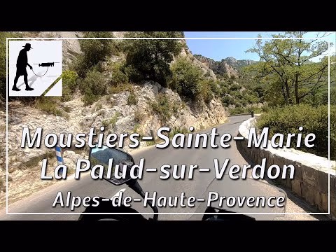
About 2 km south of the village of Moustiers-Sainte-Marie, the D952 road, which is about 17 km long, begins at a roundabout and leads to the village of La Palud-sur-Verdon. The road always runs along the north side of the Gorges du Verdon. At first, the road runs through a wooded area for about 5 km, then the view of Lac de Sainte-Croix to the south opens up. From here on, the surroundings become steeper and the road is partly cut into the rock. The Col de l'Olivier is reached after another 4 km. The road moves away from the gorge a little and the tree cover becomes a little denser again. Then the area becomes flatter and there are some grassy areas until you reach the highest point of the route at Col d'Ayen at 1031 metres. From here, the route descends slightly until you reach the village of La Palud-sur-Verdon after another 2.5 km.
The D952 road is very well maintained and easy to follow. The road is located in the department of Alpes-de-Haute-Provence and there in the region of Provence-Alpes-Cote d'Azur.
▬ Content ▬▬▬▬▬▬▬▬▬▬▬▬▬▬▬▬
00:00 Intro
00:15 Prolog
01:15 The Ride
20:02 Outro
▬ Links ▬▬▬▬▬▬▬▬▬▬▬▬▬▬▬▬▬
Playlist France: https://www.youtube.com/playlist?list=PLTYKWgwieoeK4dDbNJy2hHub-Z9y8Fz89
Playlist Gorges: https://www.youtube.com/playlist?list=PLTYKWgwieoeJHap1bKTsn_Pcjo8_V89rP
WalkTheMavic: https://www.youtube.com/channel/UCVKby-_mUxgoSbw19i30v6Q
▬ About this channel ▬▬▬▬▬▬▬▬▬▬▬▬
Walk The Mavic (WTM) – Interesting roads, passes and gorges in the Alps – Nature and landscapes – Castles, forts, fortresses and fortifications – Photos and videos, if possible and allowed, also aerial photos/videos with the drone.