
Description
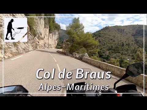
The D2204 connecting road between the towns of L'Escaréne in the west and Sospel in the east is 24 km long and leads over the Col de Braus, which is about 1000 metres high. The western ascent from L'Escaréne is 10 km long and follows a very well-maintained and easy road. On this side of the ascent, the road offers a group of many serpentines, some of them quite narrow, on which some important rally events are also held. The Col de Braus was also an integral part of the Tour de France until 1947. The road is located in the province of Provence-Alpes-Côte d'Azur and there in the department of Alpes-Maritimes / Maritime Alps.
▬ Content ▬▬▬▬▬▬▬▬▬▬▬▬▬▬▬▬
00:00 Intro
00:15 Prolog
01:01 The Ride
14:23 Outro
▬ Links ▬▬▬▬▬▬▬▬▬▬▬▬▬▬▬▬▬
Playlist France: https://www.youtube.com/playlist?list=PLTYKWgwieoeK4dDbNJy2hHub-Z9y8Fz89
Playlist Passes: https://www.youtube.com/playlist?list=PLTYKWgwieoeK6AgzgiS20gB7sWXHpboC_
WalkTheMavic: https://www.youtube.com/channel/UCVKby-_mUxgoSbw19i30v6Q
▬ About this channel ▬▬▬▬▬▬▬▬▬▬▬▬
Walk The Mavic (WTM) – Interesting roads, passes and gorges in the Alps – Nature and landscapes – Castles, forts, fortresses and fortifications – Photos and videos, if possible and allowed, also aerial photos/videos with the drone.