
Description
About 2.5 km south-west of Sestriere and 5.5 km south-east of Cesane Torinese lies the Italian village of Sauze di Cesane, where the Argentera Valley begins. Approx. 1.5 km south of Sauze di Cesane, a small spur road branches off the SP 215 road and after about 500 metres leads to a bridge and a toll station in front of it, which marks the actual entrance to the valley. Officially, a toll of currently €3 or €5 must be paid here. However, on 8 August, the day this video was taken, various construction works were carried out and an automatic barrier system was installed. Access was toll-free on these days.
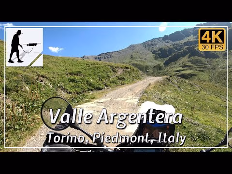
The publicly accessible part of the Valle Argentera is about 13 km long; the entire valley is about 28 km long. It leads in a south-easterly direction and ends at the border pass ‘Col de la Myat’ (2706m) at the Italian-French border, which can only be reached on foot. At first, you drive along the river Ripa on a well-maintained gravel road. After about 10 kilometres and a small climb, you reach the Piano Milizie plateau. Here the valley divides into Valle Lunga with the mountain farm ‘Alpes Planes’ and Valle Gran Miol with the mountain farm ‘Gran Miol’. From here, the route becomes very narrow, single-track and somewhat rough in places. The end of the public road is reached at the Gran Miol farm (2494m).
Valle Argentera is located in the Italian province of Torino, in the Piedmont region.
▬ Content ▬▬▬▬▬▬▬▬▬▬▬▬▬▬▬▬
00:00 Intro
00:15 Prolog
01:22 The Ride
25:50 And the Mavic spoke…
29:17 Outro
▬ Links ▬▬▬▬▬▬▬▬▬▬▬▬▬▬▬▬▬
Playlist Italy: https://www.youtube.com/playlist?list=PLTYKWgwieoeK_DKMf6p7uRpSJtF_kd7G5
Playlist Gorges: https://www.youtube.com/playlist?list=PLTYKWgwieoeJHap1bKTsn_Pcjo8_V89rP
WalkTheMavic: https://www.youtube.com/channel/UCVKby-_mUxgoSbw19i30v6Q
▬ About this channel ▬▬▬▬▬▬▬▬▬▬▬▬
Walk The Mavic (WTM) – Interesting roads, passes and gorges in the Alps – Nature and landscapes – Castles, forts, fortresses and fortifications – Photos and videos, if possible and allowed, also aerial photos/videos with the drone.