
Description
The Strada della Gardetta (Maira-Stura ridge road) is one of several roads and paths that were built in and around the Gardetta plateau. Most of the roads there are former military roads for rapid troop movements and for supplying fortifications. However, there are also roads that were built for agricultural use of the region. The roads no longer have any military significance; the road and path network is now only used for agricultural and, of course, tourist purposes.
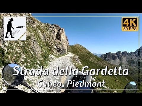
The Strada della Gardetta is a well-maintained and therefore easy to drive gravel road, around 15 km long, which connects the Colle Valcavera (2421 metres) in the south-east with the Colle del Preit (2082 metres) in the north-west. The road runs in a wide arc to the south and south-west around the Gardetta plateau and offers impressive views of the Alpine landscape. The road runs at an altitude of around 2100 to 2400 metres throughout, so you should keep a close eye on the weather in the region. A slippery road surface should be expected in damp conditions; washouts and even landslides are to be expected during (heavy) rainfall.
When travelling from Colle Valcavera, you cross several small passes such as Colle Bandia, Colle Margherina and Colle Cologna. You also pass the Caserne Della Bandia fortifications and the turn-off to Colle d'Ancoccia.
Various restrictions apply when travelling along the Strada della Gardetta, which should be observed. There is a winter closure that applies from the beginning of November to around the end of May. There is always a general night-time driving ban from 9 pm to 6 am. In the period from 27 July to 28 September, the road may NOT be used on Saturdays, Sundays and public holidays between 9 am and 6 pm. In addition, there is a complete ban on motorised vehicles during the ‘Ferrogosto’ holiday period, which begins on 15 August each year and lasts around 2 weeks, depending on the location of the weekends.
The road is located in the Italian province of Cuneo in the Piedmont region.
▬ Content ▬▬▬▬▬▬▬▬▬▬▬▬▬▬▬▬
00:00 Intro
00:15 Prolog
01:32 The Ride
31:43 And the Mavic spoke…
35:44 Outro
▬ Links ▬▬▬▬▬▬▬▬▬▬▬▬▬▬▬▬▬
Playlist Italy: https://www.youtube.com/playlist?list=PLTYKWgwieoeK_DKMf6p7uRpSJtF_kd7G5
Playlist Passes: https://www.youtube.com/playlist?list=PLTYKWgwieoeK6AgzgiS20gB7sWXHpboC_
WalkTheMavic: https://www.youtube.com/channel/UCVKby-_mUxgoSbw19i30v6Q
▬ About this channel ▬▬▬▬▬▬▬▬▬▬▬▬
Walk The Mavic (WTM) – Interesting roads, passes and gorges in the Alps – Nature and landscapes – Castles, forts, fortresses and fortifications – Photos and videos, if possible and allowed, also aerial photos/videos with the drone.