
Description
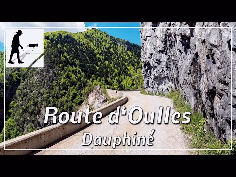
The village of Oulles is located at about 1400 meters above sea level on the southern slope of the mountain massif of 'Le Grand Galbert (2561 meters)'. A narrow road leads for about 6.5 km in serpentines up the mountain to the village. The small road branches off to the north from the D526 road, which in turn leads over the 'Col d'Ornon'. About 2 km north of Le Bourg-d'Oisans, the feeder road to this pass branches off to the west and then after another 1.5 km, the road to Oulles branches off to the north. The road is cut out of the rock in parts and passes some overhangs. If two cars meet, you have to pass each other very carefully, but in some places one has to look for the next passing place. Otherwise, the road is easy to drive on. The road is located in the department of Auvergne-Rhône-Alpes / Isère and there in the Dauphiné Alps.
▬ Content ▬▬▬▬▬▬▬▬▬▬▬▬▬▬▬▬
00:00 Intro
00:15 Prolog
00:58 The Ride
11:17 Outro
▬ Links ▬▬▬▬▬▬▬▬▬▬▬▬▬▬▬▬▬
Playlist France: https://www.youtube.com/playlist?list=PLTYKWgwieoeK4dDbNJy2hHub-Z9y8Fz89
Playlist Gorges: https://www.youtube.com/playlist?list=PLTYKWgwieoeJHap1bKTsn_Pcjo8_V89rP
WalkTheMavic: https://www.youtube.com/channel/UCVKby-_mUxgoSbw19i30v6Q
▬ About this channel ▬▬▬▬▬▬▬▬▬▬▬▬
Walk The Mavic (WTM) – Interesting roads, passes and gorges in the Alps – Nature and landscapes – Castles, forts, fortresses and fortifications – Photos and videos, if possible and allowed, also aerial photos/videos with the drone.