
On the western border of the Ortler Alps lies the approximately 42 km long crossing (road SS300) over the Passo Gavia, which connects the town of Bormio in the province of Sondrio in the north with the town of Ponte di Legno in the province of Brescia in the south.
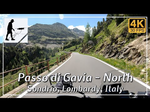
The northern ascent starts in Valtellina and leads along a well-maintained, mostly two-lane and continuously paved road for about 25 km to the pass summit.
The southern ascent, which is just under 18 km long, begins in Ponte di Legno in Val di Sole and is well constructed and paved throughout. However, much of the route is very narrow and most of the hairpin bends are very tight. It is difficult for cars and motorcycles to pass each other, but it is possible. If two cars meet, one of them has to drive back to the next passing place, which can be quite a distance. The southern ascent also includes an approximately 800-meter-long unlit tunnel.
The height of the Passo di Gavia, which leads between the peaks of Monte Gavia (3223 meters) and Corno dei Tre Signori (3360 meters), is given as 2618 meters. The Rifugio Bonetta is located at the top of the pass.
The pass is usually closed from October/November to June. The exact period is adjusted to the prevailing weather conditions.
The Passo di Gavia is also occasionally used in the Giro d’Italia cycling race. On both the north and south sides, there is an elevation gain of around 1400 meters to overcome.
The road is located in the Italian province of Sondrio in the Lombardy region.
▬ Content ▬▬▬▬▬▬▬▬▬▬▬▬▬▬▬▬
00:00 Intro
00:15 Prolog
01:32 The Ride
30:30 And the Mavic spoke
34:32 Outro
▬ Links ▬▬▬▬▬▬▬▬▬▬▬▬▬▬▬▬▬
Playlist Italy: https://www.youtube.com/playlist?list=PLTYKWgwieoeK_DKMf6p7uRpSJtF_kd7G5
Playlist Passes: https://www.youtube.com/playlist?list=PLTYKWgwieoeK6AgzgiS20gB7sWXHpboC_
WalkTheMavic: https://www.youtube.com/channel/UCVKby-_mUxgoSbw19i30v6Q
▬ About this channel ▬▬▬▬▬▬▬▬▬▬▬▬
Walk The Mavic (WTM) – Interesting roads, passes and gorges in the Alps – Nature and landscapes – Castles, forts, fortresses and fortifications – Photos and videos, if possible and allowed, also aerial photos/videos with the drone.