
Description
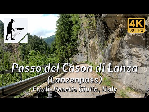
The crossing over the Passo del Cason di Lanza (Lanzenpass), which is approximately 1552 meters high, connects the towns of Paularo in the west and Pontebba in the east with a road that is approximately 31 km long in total. The eastern ascent from Pontebba, which is 561 metres above sea level, is about 15 km long, which is about the same length as the western ascent from Paularo (648 metres). The Rifugio Casera Cason di Lanza mountain hut is located at the top of the pass.
With the exception of a few passing places, the road is single-lane and of below-average quality. When two cars meet, it is rather difficult to pass each other; motorcycles have it a little easier. However, damaged pasture fences and washed-up sand and debris can be a problem, especially for motorcycles.
The western ramp from Paularo leads through the Canale d'Incaroio and has a gradient of up to 18% in some places.
From the western ramp, about 2 km west of the pass, the access road to the Passo Polentin / Straniger Sattel border pass branches off to the north.
The road is located in the Italian province of Udine in the Friuli-Venezia Giulia region.
▬ Content ▬▬▬▬▬▬▬▬▬▬▬▬▬▬▬▬
00:00 Intro
00:15 Prolog
01:22 The Ride
24:30 And the Mavic spoke
28:30 Outro
▬ Links ▬▬▬▬▬▬▬▬▬▬▬▬▬▬▬▬▬
Playlist Italy: https://www.youtube.com/playlist?list=PLTYKWgwieoeK_DKMf6p7uRpSJtF_kd7G5
Playlist Passes: https://www.youtube.com/playlist?list=PLTYKWgwieoeK6AgzgiS20gB7sWXHpboC_
WalkTheMavic: https://www.youtube.com/channel/UCVKby-_mUxgoSbw19i30v6Q
▬ About this channel ▬▬▬▬▬▬▬▬▬▬▬▬
Walk The Mavic (WTM) – Interesting roads, passes and gorges in the Alps – Nature and landscapes – Castles, forts, fortresses and fortifications – Photos and videos, if possible and allowed, also aerial photos/videos with the drone.