
The road over the 1,750-meter-high Monte Zoncolan was built around 1940. However, as soon as it was completed, the road sank back into obscurity. This only changed with the development of several large ski resorts on Monte Zoncolan.
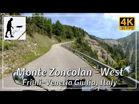
The western ascent, which begins in the village of Ovara and is about 10 km long, has been rebuilt. The three tunnels on this ascent have also been repaired and now feature a motion-detector-controlled lighting system.
The western ascent is quite steep with an average gradient of 11.5% (maximum gradients of up to 23%). In the last quarter of the route, the road narrows and becomes single-lane. Here, and especially in the tunnels, you must watch out for oncoming traffic.
The old eastern ascent from Priola was replaced by a new road that begins west of Sutrio and is about 13 km long.
The average gradient of the eastern ascent is about 8% (with peak gradients of up to 14%). Only a few kilometers before the summit does the new road meet the old pass road again. Until then, the road is very wide and excellently constructed.
Since 2003, Monte Zoncolan has been used for several stages of the Giro d’Italia. Due to some very steep sections, it is a particular challenge for every cyclist.
The road is located in the Italian province of Udine in the Friuli-Venezia Giulia region.
▬ Content ▬▬▬▬▬▬▬▬▬▬▬▬▬▬▬▬
00:00 Intro
00:15 Prolog
01:12 The Ride
16:18 And the Mavic spoke
20:18 Outro
▬ Links ▬▬▬▬▬▬▬▬▬▬▬▬▬▬▬▬▬
Playlist Italy: https://www.youtube.com/playlist?list=PLTYKWgwieoeK_DKMf6p7uRpSJtF_kd7G5
Playlist Passes: https://www.youtube.com/playlist?list=PLTYKWgwieoeK6AgzgiS20gB7sWXHpboC_
WalkTheMavic: https://www.youtube.com/channel/UCVKby-_mUxgoSbw19i30v6Q
▬ About this channel ▬▬▬▬▬▬▬▬▬▬▬▬
Walk The Mavic (WTM) – Interesting roads, passes and gorges in the Alps – Nature and landscapes – Castles, forts, fortresses and fortifications – Photos and videos, if possible and allowed, also aerial photos/videos with the drone.