
Description
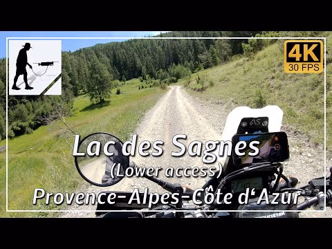
From the village of Jausiers, the ascent to the Col de la Bonette takes the C4 road (formerly D64) in a south-easterly direction. After just under 3 km and about halfway to the village of Lans, the access road to Lac des Sagnes turns left in a right-hand hairpin bend. From here, the well-maintained and fairly easy gravel road immediately begins, which leads to the lake after about 10.5 km.
The path mainly runs along the south side of the Vallon des Sagnes, which is part of the Mercantour National Park. The trail ends at an altitude of around 1890 metres directly at the lake. From here, the path is closed to public transport; it is not possible to continue. To the south of the lake is the pyramid-shaped mountain La Tour des Sagenes; to the north-east is the Cascade du Pisson waterfall.
The whole area is popular with hikers and mountain bikers, so you should take care when travelling.
The road is located in the Alpes-de-Haute-Provence department in the province of Provence-Alpes-Côte d'Azur.
▬ Content ▬▬▬▬▬▬▬▬▬▬▬▬▬▬▬▬
00:00 Intro
00:15 Prolog
01:22 The Ride
18:59 And the Mavic spoke…
22:29 Outro
▬ Links ▬▬▬▬▬▬▬▬▬▬▬▬▬▬▬▬▬
Playlist France: https://www.youtube.com/playlist?list=PLTYKWgwieoeK4dDbNJy2hHub-Z9y8Fz89
Playlist Gorges: https://www.youtube.com/playlist?list=PLTYKWgwieoeJHap1bKTsn_Pcjo8_V89rP
WalkTheMavic: https://www.youtube.com/channel/UCVKby-_mUxgoSbw19i30v6Q
▬ About this channel ▬▬▬▬▬▬▬▬▬▬▬▬
Walk The Mavic (WTM) – Interesting roads, passes and gorges in the Alps – Nature and landscapes – Castles, forts, fortresses and fortifications – Photos and videos, if possible and allowed, also aerial photos/videos with the drone.