
Description
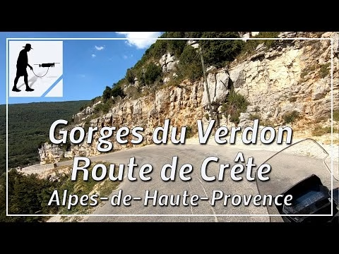
The Gorges du Verdon runs mainly in an east-west direction. On the north side of this gorge is a plateau with the main town of La Palud-sur-Verdon, which is also the starting and ending point for the D23 road. This road, also called Route de Crête, forms a circular route about 22 km long. The road is well-maintained and easy to follow. Special care should be taken when driving near the viewpoints, as you have to be aware of parked and manoeuvring cars as well as pedestrians. The middle third of the route is a one-way street, so the route is only fully navigable in a clockwise direction. Nevertheless, it happens that vehicles drive in the wrong direction in this part of the route as well. The road is located in the Alpes-de-Haute-Provence department, in the Provence-Alpes-Cote d'Azur region.
▬ Content ▬▬▬▬▬▬▬▬▬▬▬▬▬▬▬▬
00:00 Intro
00:15 Prolog
01:23 The Ride
26:19 And the Mavic spoke…
30:39 Outro
▬ Links ▬▬▬▬▬▬▬▬▬▬▬▬▬▬▬▬▬
Playlist France: https://www.youtube.com/playlist?list=PLTYKWgwieoeK4dDbNJy2hHub-Z9y8Fz89
Playlist Gorges: https://www.youtube.com/playlist?list=PLTYKWgwieoeJHap1bKTsn_Pcjo8_V89rP
WalkTheMavic: https://www.youtube.com/channel/UCVKby-_mUxgoSbw19i30v6Q
Subscribe WalkTheMavic: https://www.youtube.com/channel/UCVKby-_mUxgoSbw19i30v6Q?sub_confirmation=1
▬ About this channel ▬▬▬▬▬▬▬▬▬▬▬▬
Walk The Mavic (WTM) – Interesting roads, passes and gorges in the Alps – Nature and landscapes – Castles, forts, fortresses and fortifications – Photos and videos, if possible and allowed, also aerial photos/videos with the drone.