
Description
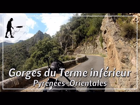
About 8 km west of the village of Céret, the Mondony River, coming from the south, joins the Tech River at Amélie-les-Bains-Palalda. The Mondony River rises in the highlands of the eastern Pyrenees and has created an impressive gorge over time. Directly south of Amélie-les-Bains-Palalda is the narrowest and steepest cut in the gorge, which is only accessible on foot via an artificial via ferrata. Further south, the gorge widens into a valley in which a small road could also be built on the left / western side of the river. Some houses and settlements and also the hamlet of Montalba d'Améli can be reached via this road. The section shown is about 8 km long and leads from Amélie-les-Bains to the Pont du Can Pagris Ouest. About halfway, at the Salt d'aigua de Mascarat waterfall, the road forks. The D53 road continues to the left / east over a stone bridge to Montalba. To the right, the D53B road then continues through the Gorges du Terme inférieur. The road is quite narrow, especially in the second half of the route; if there is oncoming traffic, you may have to backtrack to the next passing point. Some blind bends, dirt on the road and in some places falling rocks force you to drive carefully and slowly. The road is located in the department of Pyrénées-Orientales, in the Occitanie region.
This route belongs to the so-called "French Balcony Roads".
▬ Content ▬▬▬▬▬▬▬▬▬▬▬▬▬▬▬▬
00:00 Intro
00:15 Prolog
01:15 The Ride
13:15 Outro
▬ Links ▬▬▬▬▬▬▬▬▬▬▬▬▬▬▬▬▬
Playlist France: https://www.youtube.com/playlist?list=PLTYKWgwieoeK4dDbNJy2hHub-Z9y8Fz89
Playlist Gorges: https://www.youtube.com/playlist?list=PLTYKWgwieoeJHap1bKTsn_Pcjo8_V89rP
WalkTheMavic: https://www.youtube.com/channel/UCVKby-_mUxgoSbw19i30v6Q
▬ About this channel ▬▬▬▬▬▬▬▬▬▬▬▬
Walk The Mavic (WTM) – Interesting roads, passes and gorges in the Alps – Nature and landscapes – Castles, forts, fortresses and fortifications – Photos and videos, if possible and allowed, also aerial photos/videos with the drone.