
Description
The Col de Mont Cenis marks the border between France in the north and Italy in the south. It connects the French Maurienne Valley with the Italian Susa Valley. Forts were built on both sides of the border to fortify the pass and protect against aggression from the other side. While several fortifications were built on the Italian side (e.g. Ronce, Malamot and Pattacreuse), only one fort was built on the French side: Fort de la Turra. Construction of the fort began in the 1890s and ended around 1905.
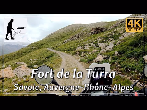
The fort is located at an altitude of 2507 metres and can be reached via a stony and partly rocky path. The path is about 7.5 kilometres long and starts from the Maurienne valley about 2 kilometres before the Col de Mont Cenis pass. Please note that the route has been closed to motorised traffic for some time.
The Fort de la Turra is located in the department of Savoie in the province of Auvergne-Rhône-Alpes.
▬ Content ▬▬▬▬▬▬▬▬▬▬▬▬▬▬▬▬
00:00 Intro
00:15 Prolog
01:22 The Ride
18:59 And the Mavic spoke…
20:35 Outro
▬ Links ▬▬▬▬▬▬▬▬▬▬▬▬▬▬▬▬▬
Playlist France: https://www.youtube.com/playlist?list=PLTYKWgwieoeK4dDbNJy2hHub-Z9y8Fz89
Playlist Passes: https://www.youtube.com/playlist?list=PLTYKWgwieoeK6AgzgiS20gB7sWXHpboC_
WalkTheMavic: https://www.youtube.com/channel/UCVKby-_mUxgoSbw19i30v6Q
▬ About this channel ▬▬▬▬▬▬▬▬▬▬▬▬
Walk The Mavic (WTM) – Interesting roads, passes and gorges in the Alps – Nature and landscapes – Castles, forts, fortresses and fortifications – Photos and videos, if possible and allowed, also aerial photos/videos with the drone.