
Description
A total of 4 major ascents lead up to the 2481 metre high Colle della Fauniera.
1. from the Italian town of Demonte, the approximately 24 km long, fully asphalted ascent leads through the Valone dell'Arma in a north-westerly direction. Just 2 km before the Colle Fauniera, you also pass the Colle Valcavera, which at 2421 metres is only slightly lower.
2. coming from the north-west, a gravel road, the Maira-Stura ridge road, meets the Colle Valcavera (2421 metres). From here it is less than 2 kilometres to Colle Fauniera. The Maira-Stura ridge road begins to the north in the village of Marmora. The last 15 km of this stretch is an unpaved gravel road.
3. the SP113 road to Colle Fauniera, which is asphalted throughout, also begins in the village of Marmora. The approximately 17 km long ascent first reaches the Colle d'Esischie (2370 metres) and then the Colle Fauniera just 1 km further on.
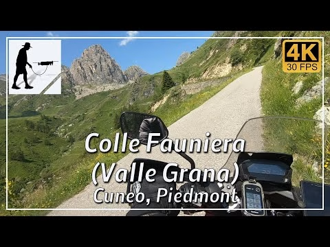
4. the SP333 road leads from the east through the Valle Grana, first past the Colle d'Esischie to the Colle Faueira. The road is asphalted throughout and from the village of Campomolino it is about 15 kilometres.
Colle Fauniera is also known as Colle dei Morti because of the fierce and bloody fighting that took place here during the world wars. Today, the area is a popular destination for hikers, cyclists and motorcyclists. A monument to the famous cyclist Pantani, which was erected on Colle Fauniera, honours his sporting achievements.
The Valle Grana is a valley incision that begins in the plain west of Cuneo or Caraglio and leads westwards for about 25 kilometres as the crow flies to end at Colle Fauniera. The SP23, SP112 and then the SP333 road run through the valley. The road passes the villages of Valgrana, Pradleves, Campololino and the Santuario S. Magno Castelmagno. Up to the Santuario, the road is two-lane throughout and easy to drive on. From here onwards, the road becomes single-lane and at times quite narrow and confusing. Cyclists and pedestrians are to be expected.
The road is located in the Italian province of Cuneo in the Piedmont region.
▬ Content ▬▬▬▬▬▬▬▬▬▬▬▬▬▬▬▬
00:00 Intro
00:15 Prolog
01:15 The Ride
24:37 Outro
▬ Links ▬▬▬▬▬▬▬▬▬▬▬▬▬▬▬▬▬
Playlist Italy: https://www.youtube.com/playlist?list=PLTYKWgwieoeK_DKMf6p7uRpSJtF_kd7G5
Playlist Passes: https://www.youtube.com/playlist?list=PLTYKWgwieoeK6AgzgiS20gB7sWXHpboC_
WalkTheMavic: https://www.youtube.com/channel/UCVKby-_mUxgoSbw19i30v6Q
Subscribe WalkTheMavic: https://www.youtube.com/channel/UCVKby-_mUxgoSbw19i30v6Q?sub_confirmation=1
▬ About this channel ▬▬▬▬▬▬▬▬▬▬▬▬
Walk The Mavic (WTM) – Interesting roads, passes and gorges in the Alps – Nature and landscapes – Castles, forts, fortresses and fortifications – Photos and videos, if possible and allowed, also aerial photos/videos with the drone.