
Description
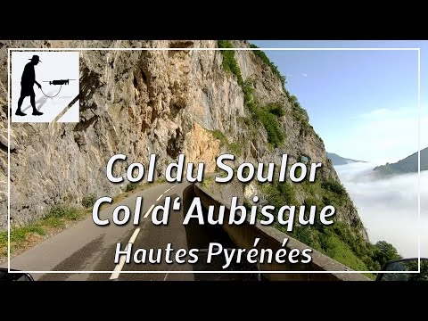
Over a total distance of just over 45 km, the D918 road connects the towns of Argelès-Gazost in the east and Laruns in the west. The road thus starts in the Occitanie region in the Hautes Pyrénées département and reaches the 1474 meter high Col du Soulor after about 19 km. From here, the road connects the two passes Col du Soulor and Col d'Aubisque in the west. At first, the road drops a little, then rises again to Col d'Aubisque at 1709 meters. From here on, the road descends steadily until you first reach the ski resorts of Gourette and Eaux-Bonnes and then, after about 15 km, the village of Laruns. Laruns and the pass Col d'Aubisque are located in the department Pyrénées-Atlantiques and there in the region Nouvelle-Aquitaine. The road is well maintained and overall easy to drive. The route was and is part of the Tour de France. Thus, the route also enjoys great popularity among recreational athletes to which one should pay particular attention. Due to the exposed location, a winter closure must be expected on the route between the two passes, which can extend well into the month of May.
This route belongs to the so-called "French Balcony Roads".
▬ Content ▬▬▬▬▬▬▬▬▬▬▬▬▬▬▬▬
00:00 Intro
00:15 Prolog
01:15 The Ride
17:28 Outro
▬ Links ▬▬▬▬▬▬▬▬▬▬▬▬▬▬▬▬▬
Playlist France: https://www.youtube.com/playlist?list=PLTYKWgwieoeK4dDbNJy2hHub-Z9y8Fz89
Playlist Passes: https://www.youtube.com/playlist?list=PLTYKWgwieoeK6AgzgiS20gB7sWXHpboC_
WalkTheMavic: https://www.youtube.com/channel/UCVKby-_mUxgoSbw19i30v6Q
▬ About this channel ▬▬▬▬▬▬▬▬▬▬▬▬
Walk The Mavic (WTM) – Interesting roads, passes and gorges in the Alps – Nature and landscapes – Castles, forts, fortresses and fortifications – Photos and videos, if possible and allowed, also aerial photos/videos with the drone.