
Description
The strategic importance of a military road link between the Durance and Ubaye valleys (e.g. Fort de Tournoux) was recognised as early as the 16th century and corresponding construction projects were initiated. However, it was not until 1911 that this connection could be established, as it was only then that the technical requirements for the construction of the necessary crest tunnel were met. Construction of the 520 metre long tunnel began around 1891 and therefore took around 20 years. The tunnel passes under the natural pass height of 2780 metres at an altitude of 2632 metres. Today, the pass is no longer of any military or commercial significance. It is poorly developed (approx. 25 kilometres of gravel road) and the simple passage through the tunnel is very dependent on weather conditions. The Col du Parpaillon has been replaced in almost all respects by the parallel Col de Vars pass a little further to the east.
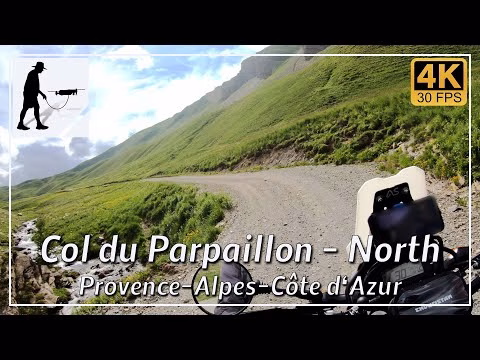
The northern ascent begins at the village of Crévoux / La Chap, which can be reached from Emdrun (N94) after a long journey. From here, the D39T road leads for about 12 kilometres to the pass tunnel. The first third of the road is still tarmac, the second third is a gravel road and the last third consists of clay soil, which can quickly become dangerously slippery when wet.
The northern ascent is located in the Hautes-Alpes department in the province of Provence-Alpes-Côte d'Azur.
ATTENTION: In December 2023, a landslide damaged the south side of the Col du Parpaillon. However, the route is now passable again and the southern tunnel portal has been uncovered. But there was also a rockfall inside the tunnel, which is in a very unstable condition. The tunnel is closed and should NOT be entered or travelled through. A reopening is uncertain.
▬ Content ▬▬▬▬▬▬▬▬▬▬▬▬▬▬▬▬
00:00 Intro
00:15 Prolog
01:22 The Ride
21:38 And the Mavic spoke…
24:50 Outro
▬ Links ▬▬▬▬▬▬▬▬▬▬▬▬▬▬▬▬▬
Playlist France: https://www.youtube.com/playlist?list=PLTYKWgwieoeK4dDbNJy2hHub-Z9y8Fz89
Playlist Passes: https://www.youtube.com/playlist?list=PLTYKWgwieoeK6AgzgiS20gB7sWXHpboC_
WalkTheMavic: https://www.youtube.com/channel/UCVKby-_mUxgoSbw19i30v6Q
▬ About this channel ▬▬▬▬▬▬▬▬▬▬▬▬
Walk The Mavic (WTM) – Interesting roads, passes and gorges in the Alps – Nature and landscapes – Castles, forts, fortresses and fortifications – Photos and videos, if possible and allowed, also aerial photos/videos with the drone.