
Description
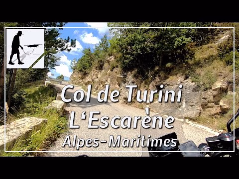
There are three major ascents to the Col de Turini. The ascent that starts in L'Escarène is about 25 km long and passes through the villages of Lucéram and Peira-Cava. From Lucéran you have the option of turning left just after the village and staying on the D2566 road, or turning right and following the D21 road. This alternative is a bit steeper and has some sections that go over narrow switchbacks. The road is very well maintained and easy to drive. In some places there are remarkable views to the south.
Other ascents to the Col de Turini, which is about 1600 meters high, include.
Sospel: https://youtu.be/G5mNu1TYv-4
La Bollène-Vésubie: https://youtu.be/Jm8nf03lGJM
The road is located in the province of Provence-Alpes-Côte d'Azur and there in the department of Alpes-Maritimes / Maritime Alps.
▬ Content ▬▬▬▬▬▬▬▬▬▬▬▬▬▬▬▬
00:00 Intro
00:15 Prolog
01:15 The Ride
34:21 Outro
▬ Links ▬▬▬▬▬▬▬▬▬▬▬▬▬▬▬▬▬
Playlist France: https://www.youtube.com/playlist?list=PLTYKWgwieoeK4dDbNJy2hHub-Z9y8Fz89
Playlist Passes: https://www.youtube.com/playlist?list=PLTYKWgwieoeK6AgzgiS20gB7sWXHpboC_
WalkTheMavic: https://www.youtube.com/channel/UCVKby-_mUxgoSbw19i30v6Q
▬ About this channel ▬▬▬▬▬▬▬▬▬▬▬▬
Walk The Mavic (WTM) – Interesting roads, passes and gorges in the Alps – Nature and landscapes – Castles, forts, fortresses and fortifications – Photos and videos, if possible and allowed, also aerial photos/videos with the drone.