
Description
The main access road to the Col de Tende is the D6204 road, which leads northwards through the Roya Valley and then connects to the Italian region of Cuneo via a road tunnel. After storm ‘Alex’ devastated the Roya Valley in October 2020, also destroying the southern tunnel entrance, even the old pass access road (Route des 46 Lacets) has been reopened.
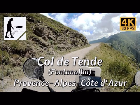
However, there is a second southern ascent to the Col de Tende. If you turn west onto the D91 road in Saint-Dalmas de Tende, a village on the D6204 road about 16 km south of the Col de Tende, this leads after about 14 km to the Refuge de Fontanalbe, a centre for hiking in summer and winter sports. Here, in the valley of the Fontanalba river, the ascent to the Col de Tende begins.
The ascent is around 16 kilometres long. Longer sections alternate with gravel and tarmac. However, some of the tarmac sections are in poor condition. There is also an unlit tunnel on the route. Overall, however, the route is easy to cycle. However, special attention should be paid to hikers and cyclists.
The road is located in the Provence-Alpes-Côte d'Azur and there in the Alpes-Maritimes / Maritime Alps.
▬ Content ▬▬▬▬▬▬▬▬▬▬▬▬▬▬▬▬
00:00 Intro
00:15 Prolog
01:22 The Ride
25:22 And the Mavic spoke…
29:24 Outro
▬ Links ▬▬▬▬▬▬▬▬▬▬▬▬▬▬▬▬▬
Playlist France: https://www.youtube.com/playlist?list=PLTYKWgwieoeK4dDbNJy2hHub-Z9y8Fz89
Playlist Passes: https://www.youtube.com/playlist?list=PLTYKWgwieoeK6AgzgiS20gB7sWXHpboC_
WalkTheMavic: https://www.youtube.com/channel/UCVKby-_mUxgoSbw19i30v6Q
▬ About this channel ▬▬▬▬▬▬▬▬▬▬▬▬
Walk The Mavic (WTM) – Interesting roads, passes and gorges in the Alps – Nature and landscapes – Castles, forts, fortresses and fortifications – Photos and videos, if possible and allowed, also aerial photos/videos with the drone.