
Description
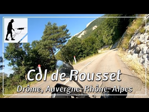
The Col de Rousset is a mountain pass about 1300 metres high that climbs from the south to the Vercors plateau. From the D92 road, which runs from Saint-Croix in the west to the village of Die, the D518 road branches off to the north just before Die. The road leads through the village of Chamaloc, from where the actual ascent of the pass begins. From Chamaloc it is about 15km. Shortly before the top of the pass, the ascent is shortened by a crest tunnel. The road is well-maintained, clear and easy to drive on. Just before the southern entrance of the crest tunnel, there is a turn-off to the old closed pass road, which can be used for a break and for a view of the ascent. The road is located in the department of Drôme and there in the Auvergne-Rhône-Alpes region.
▬ Content ▬▬▬▬▬▬▬▬▬▬▬▬▬▬▬▬
00:00 Intro
00:15 Prolog
01:15 The Ride
17:37 Outro
▬ Links ▬▬▬▬▬▬▬▬▬▬▬▬▬▬▬▬▬
Playlist France: https://www.youtube.com/playlist?list=PLTYKWgwieoeK4dDbNJy2hHub-Z9y8Fz89
Playlist Passes: https://www.youtube.com/playlist?list=PLTYKWgwieoeK6AgzgiS20gB7sWXHpboC_
WalkTheMavic: https://www.youtube.com/channel/UCVKby-_mUxgoSbw19i30v6Q
▬ About this channel ▬▬▬▬▬▬▬▬▬▬▬▬
Walk The Mavic (WTM) – Interesting roads, passes and gorges in the Alps – Nature and landscapes – Castles, forts, fortresses and fortifications – Photos and videos, if possible and allowed, also aerial photos/videos with the drone.