
Description
The northern and southern approaches to the Col de l'Iseran are located in the department of Savoie in the Auvergne-Rhône-Alpes region. The pass connects the village of Bonneval-sur-Arc in the south with the village of Val d'Isère and the ski resort of the same name in the north. At 2770 metres, the pass is the highest pass in the Alps that can be driven over on asphalt. Only the summit loop, not the pass itself, around the Cime de la Bonette is slightly higher at 2802 metres.
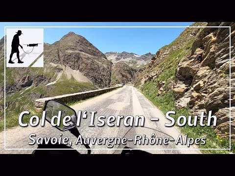
The southern ascent of the pass from Bonneval-sur-Arc is around 13 kilometres long. The northern one is just under 14 kilometres from Le Fornet, a suburb of Val d'Isère. Both pass access roads are very well developed, two lanes in total and therefore easy to drive on. On the south side, there is a rocky embrasure with a small tunnel that can be a little narrow.
The pass is located in the department of Savoie in the Auvergne-Rhône-Alpes region.
▬ Content ▬▬▬▬▬▬▬▬▬▬▬▬▬▬▬▬
00:00 Intro
00:15 Prolog
01:15 The Ride
17:13 Outro
▬ Links ▬▬▬▬▬▬▬▬▬▬▬▬▬▬▬▬▬
Playlist France: https://www.youtube.com/playlist?list=PLTYKWgwieoeK4dDbNJy2hHub-Z9y8Fz89
Playlist Passes: https://www.youtube.com/playlist?list=PLTYKWgwieoeK6AgzgiS20gB7sWXHpboC_
WalkTheMavic: https://www.youtube.com/channel/UCVKby-_mUxgoSbw19i30v6Q
▬ About this channel ▬▬▬▬▬▬▬▬▬▬▬▬
Walk The Mavic (WTM) – Interesting roads, passes and gorges in the Alps – Nature and landscapes – Castles, forts, fortresses and fortifications – Photos and videos, if possible and allowed, also aerial photos/videos with the drone.