
Description
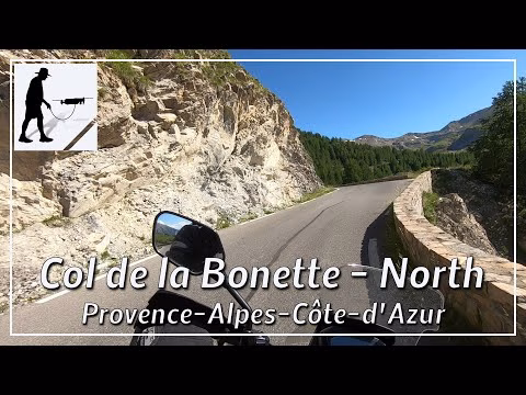
From the village of Jausiers, the northern ascent to the Col de la Bonnet leads south on the D64 road. The entire ascent is about 22 km long and leads past some settlements and often through wooded areas in the first third. Afterwards, the landscape becomes more barren and rocky. The actual pass is a relatively small rocky cut at 2715 metres above sea level. The pass forms the border between the departments of Alpes-de-Haute-Provence in the north and Alpes-Maritimes in the south, connecting the towns of Jausiers in the north with Saint-Etienne-de-Tinée in the south. At the pass, a summit loop branches off around the Cime de la Bonette, where an altitude of 2802 metres can finally be reached. The summit loop is thus the second highest asphalted road in the Alps. The entire road up to the top of the pass is quite wide, two-lane, very well constructed and thus easy to drive on. The pass summit itself has been provided with numerous, extensive bunkers. Remains of former barracks can also be found.
The road lies in the Alpes-de-Haute-Provence department and there in the province of Provence-Alpes-Côte d'Azur.
▬ Content ▬▬▬▬▬▬▬▬▬▬▬▬▬▬▬▬
00:00 Intro
00:15 Prolog
01:24 The Ride
31:20 Outro
▬ Links ▬▬▬▬▬▬▬▬▬▬▬▬▬▬▬▬▬
Playlist France: https://www.youtube.com/playlist?list=PLTYKWgwieoeK4dDbNJy2hHub-Z9y8Fz89
Playlist Passes: https://www.youtube.com/playlist?list=PLTYKWgwieoeK6AgzgiS20gB7sWXHpboC_
WalkTheMavic: https://www.youtube.com/channel/UCVKby-_mUxgoSbw19i30v6Q
▬ About this channel ▬▬▬▬▬▬▬▬▬▬▬▬
Walk The Mavic (WTM) – Interesting roads, passes and gorges in the Alps – Nature and landscapes – Castles, forts, fortresses and fortifications – Photos and videos, if possible and allowed, also aerial photos/videos with the drone.