
Description
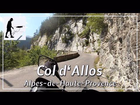
There are about 1100 meters of altitude to climb if you take the D908 road from Barcelonnette up the northern ascent to the Col d'Allos (about 2250 meters). First, one drives south from Barcelonnette on the west side of the Bachelard River. Then the road heads west to go around the Gorges de la Malune, and then continues south again to reach the top of the pass after about 17.5 km. From there you can continue downhill to Allos or Colmars. The narrow road, which is partly only one lane but has passing places, was several times a stage in the Tour de France. At the top of the pass rises the Verdon River, which is known for the impressive Gorges / Grand Canyon du Verdon. The whole area belongs to the Parc National du Mercantour and the pass is usually open from May to October. The pass and the road D908 are located in the department Alpes-de-Haute-Provence and there in the region Provence-Alpes-Côte d'Azur.
▬ Content ▬▬▬▬▬▬▬▬▬▬▬▬▬▬▬▬
00:00 Intro
00:15 Prolog
01:21 The Ride
21:49 Outro
▬ Links ▬▬▬▬▬▬▬▬▬▬▬▬▬▬▬▬▬
Playlist France: https://www.youtube.com/playlist?list=PLTYKWgwieoeK4dDbNJy2hHub-Z9y8Fz89
Playlist Passes: https://www.youtube.com/playlist?list=PLTYKWgwieoeK6AgzgiS20gB7sWXHpboC_
WalkTheMavic: https://www.youtube.com/channel/UCVKby-_mUxgoSbw19i30v6Q
▬ About this channel ▬▬▬▬▬▬▬▬▬▬▬▬
Walk The Mavic (WTM) – Interesting roads, passes and gorges in the Alps – Nature and landscapes – Castles, forts, fortresses and fortifications – Photos and videos, if possible and allowed, also aerial photos/videos with the drone.